What is a Bird Atlas?
A bird atlas is typically a citizen-science project to establish a comprehensive list of birds in a particular area and provide information on their distribution.
 Most bird atlas surveys are conducted at the state level and collect data only on breeding birds. The Loudoun County Bird Atlas is unique in that the project is county wide and includes year-round data for both breeding and non-breeding birds.
Birds provide an easy yet powerful way to connect to the natural world. They serve as important indicators of the overall health of our environment. Loudoun’s diverse habitats range from forests and wetlands to suburban parks and agricultural areas. They provide breeding, migratory and wintering sites for a variety of bird species. Loudoun Wildlife will use the Bird Atlas results to identify important bird areas, assist with environmental planning, generate information on species of special concern, guide future conservation activities and serve as a comparison for future atlas surveys.
How did we conduct our Bird Atlas survey?
We divided Loudoun County into a grid of 75 blocks based on sections of U.S. Geological Survey quadrangle maps. Each block is approximately 10 square miles. Atlas volunteers were assigned to different blocks to ensure county-wide coverage.
The volunteers used a field card to collect data on the occurrence and behavior of birds throughout the county. Data processing was handled by BBA (Breeding Bird Atlas) Explorer, an online system hosted by the USGS Patuxent Wildlife Research Center. Field data was collected from April 2009 through March 2014 and can be found here.
Outcomes of the project
- Birds of Loudoun Checklist. This revised list includes 305 bird species identified in the county through March 2014, with over 120 reported breeders.
- Bird Atlas Summary Report
- Bird Atlas results have been published in the Virginia Society of Ornithology’s publication,”The Raven,” Volume 87, Issue 1.
- Bird lists for popular birding places throughout Loudoun.
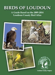
- Birds of Loudoun, a guide based on the Bird Atlas. contains in-depth species accounts, distribution maps, and stunning photographs, along with great places to bird throughout the county and information on which birds are thriving and which need our help the most. View sample species accounts and an eratta page.
Second Virginia Breeding Bird Atlas
The second Virginia Breeding Bird Atlas launched in 2016 and collected data through the 2020 breeding season. This effort has resulted in the largest baseline data set of its kind on the Commonwealth’s breeding birds, with over 15,000 points surveyed and over 230,000 individual birds counted. The project is currently in the data analysis phase. The analyses will generate a number of products that will be shared with the public and which will help guide future avian conservation efforts in Virginia. These Atlas products are anticipated to be completed by the end of 2025.
Our Work
Citizen Science News
-
The Monitor Archive The first edition of Loudoun Wildlife Conservancy’s monthly stream monitoring...
Read More -
Winged Mammals: Exploring the Fascinating World of Bats On March 24, Loudoun Wildlife Conservancy partnered with Loudoun County...
Read More -
Hands-on Training for Bluebird Monitors Held on March 17 Photo by Sharon Crowell On Sunday March 17, 30 Bluebird...
Read More

